 Fred's Guide to Lake Powell

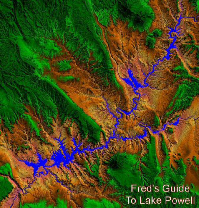
Lake Powell has 96 major canyons and almost 2000 miles of shoreline. Fred's Guide to Lake Powell shows you them all. In this section the bays are detailed, with satellite photos and topographical maps, to give you a good picture of what to expect on your Lake Powell travels. The satellite pictures were taken at a lake level of about 3680 feet above sea level. When the lake approaches full pool (3700 feet) some of the land shown will be covered with water, and conversely if the lake falls below this level more land will be exposed.
These images are not for navigation purposes. Many fine maps can be purchased for navigational purposes. Updated elevation data is available here.
Below you will find a Lake Powell relief map which you can click on to take you to the appropriate bay or canyon, including Glen Canyon below the dam to Lees Ferry.
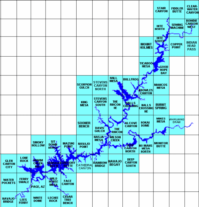
To access the topographic quadrangle maps you can click on the appropriate quadrangle on the second map below and the PDF file will open in another window.
Or you may choose the name of the bay or canyon from the list toward the bottom of the page.
There are links to the topo maps for that area on each map page. You will also see that part of the lake highlighted in red on the small map to the left at the top. You can click on that map to go to another section of the lake.