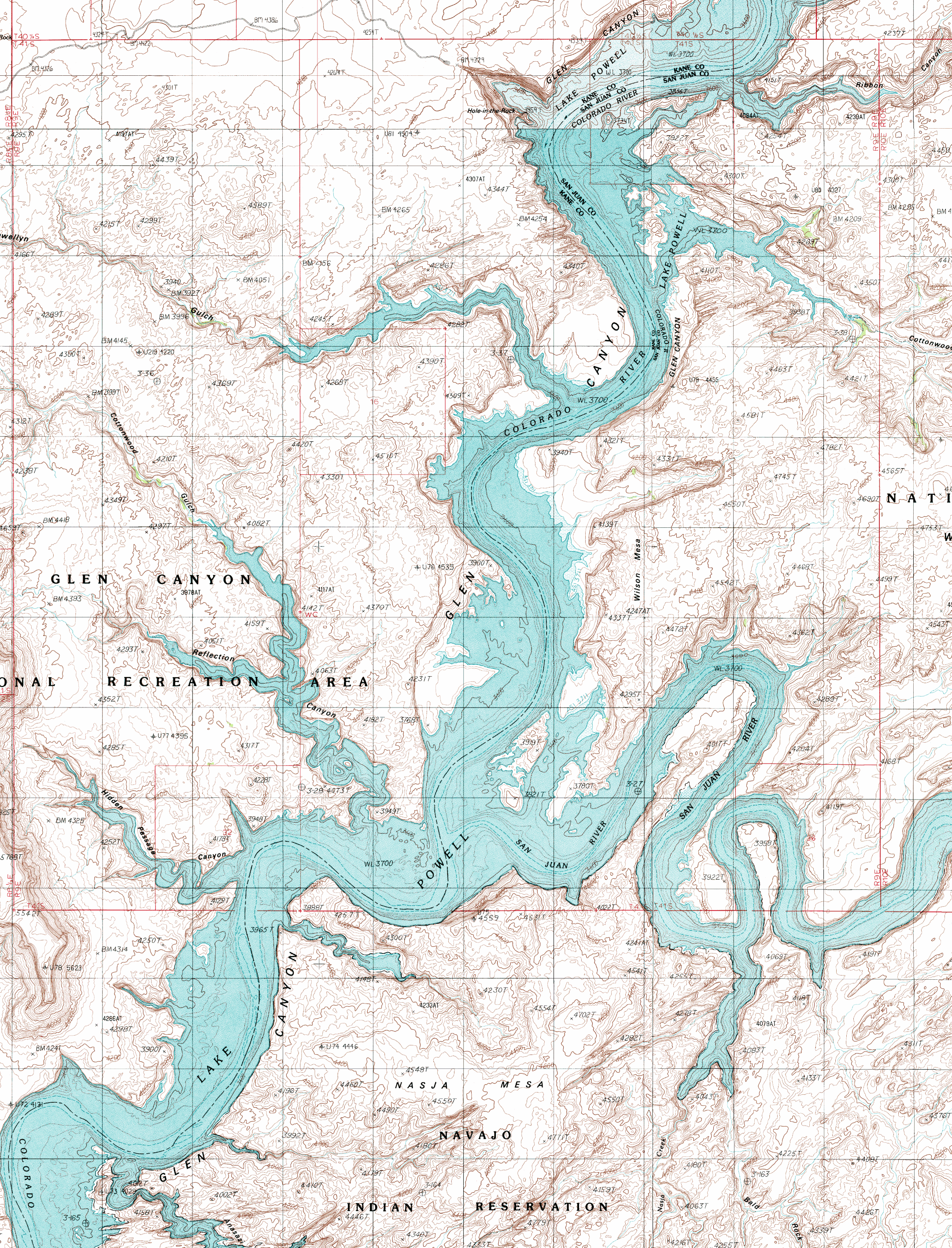
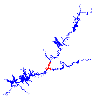
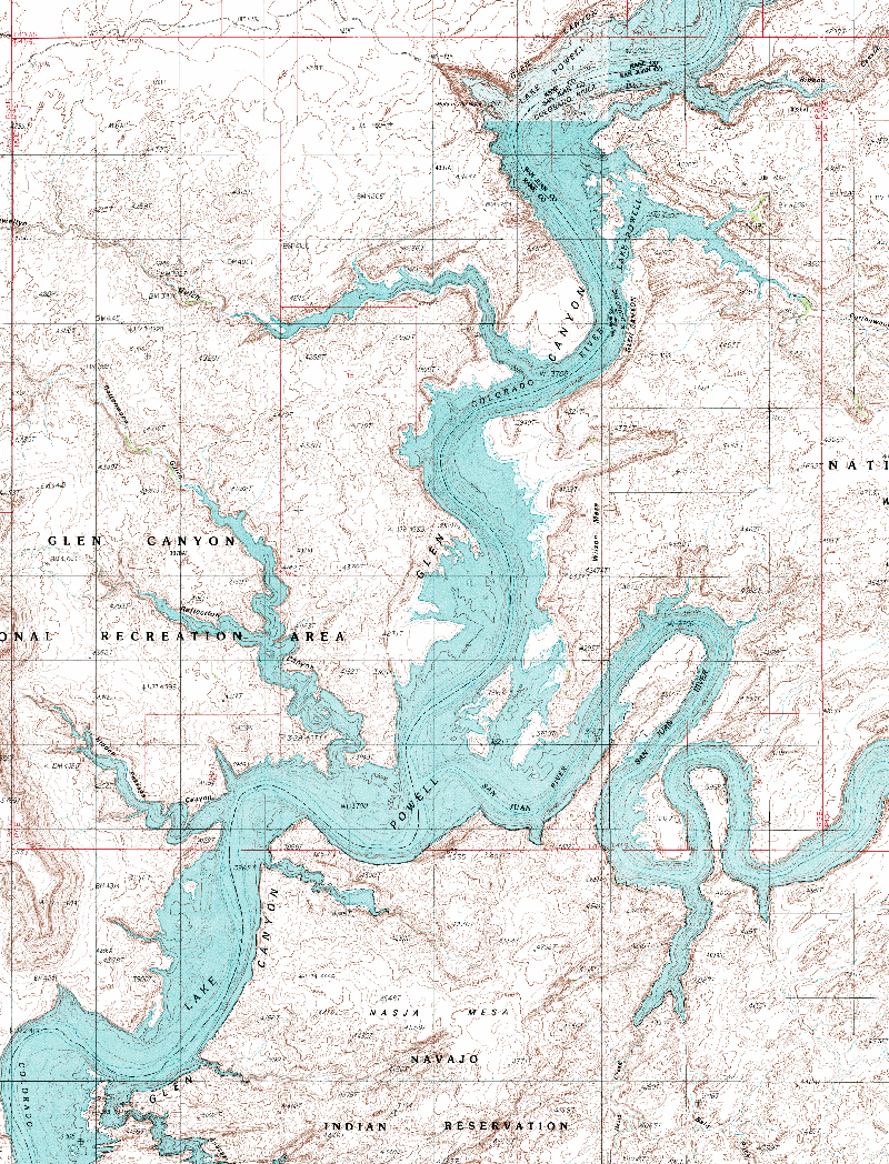
 This area of the lake has quite a history, with some areas named by John Wesley Powell during his 1869 journey down the Colorado River and other areas that served as a quite arduous trail used by Mormon pioneers in the late 1800's. The San Juan River Arm also enters in this area with several gooseneck bends. All in all this section is a very interesting and beautiful part of Lake Powell well worth the time to explore.
Adjoining Maps:
The Rincon
Rainbow Bridge
Lower San Juan
Click on the topo map below to enlarge (Note: These are large files).
Topographical Maps (PDF files, opens in a new window):
Nasja Mesa
Wilson Creek
Davis Gulch
The Rincon
Music Temple Canyon:
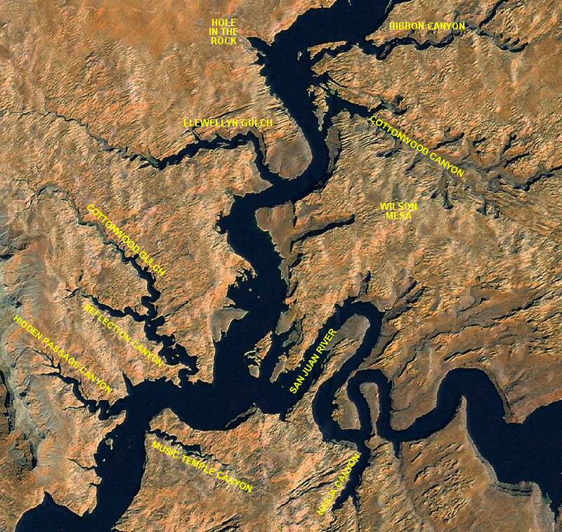
Music Temple Canyon (Mile 56) was named by John Wesley Powell for a grotto that has since been inundated by Lake Powell. It offers little or no camping. Butterfly Arch is in this canyon.
Hidden Passage Canyon:
Hidden Passage Canyon is at Mile 56. It is an interesting place to explore and was named because the entrance to the canyon at the Colorado River was difficult to find. There are no campsites here.
Reflection Canyon:
Reflection Canyon, at Mile 57, is another long, winding canyon. There is some limited camping and some hiking at the end of the canyon. There is an arch and ruins in this canyon.
San Juan River:
The San Juan River Arm enters the main channel of Lake Powell at Mile 57. It is advisable to make sure you have enough fuel before going up the San Juan Arm since there are no marinas in this part of Lake Powell. There are a couple of arches near the entrance of the San Juan Arm.
Nasja Canyon:
Nasja Canyon is five miles up the San Juan Arm. There is no camping up Nasja Canyon. Nasja Canyon was named for Nasja Begay, one of the guides for the first expedition of white men to Rainbow Bridge in 1909. Bald Rock Canyon splits off Nasja Canyon near the end. There are some archeological sites to be found if you hike up the end of this canyon.
Llewellyn Gulch:
Llewellyn Gulch, at Mile 63, contains few campsites but has some arches and petroglyphs. This canyon was named after Utah pioneer Llewellyn Harris who left several inscriptions in the Gulch, and elsewhere in the area in the late 1800's.
Cottonwood Canyon:
Cottonwood Canyon is 65 miles from Glen Canyon Dam. There are many good campsites in this canyon. There are many interesting items in or near this canyon. Triple Arch can be viewed on Wilson Mesa. There are Anasazi ruins in Cottonwood Canyon. This is also the route the Mormon pioneers took out after coming down through Hole-In-The-Rock. The canyon can be hiked up to a dirt road several miles up canyon. See the "Driving the Lake" page for directions.
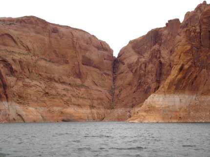
Hole-In-The-Rock:
Hole-In-The-Rock, shown below, is at Mile 66. In 1880 Mormon pioneers dug, blasted, and filled a rugged road down this 600 vertical foot passage. The History page contains a photo of Hole-In-The-Rock before Lake Powell. One can hike up this canyon or it can be accessed by road. There are no campsites in this small canyon.
Ribbon Canyon:
Ribbon Canyon, at Mile 67, offers some campsites and very spectacular scenery. The canyon can be hiked and one can get a nice view of Lake Powell.