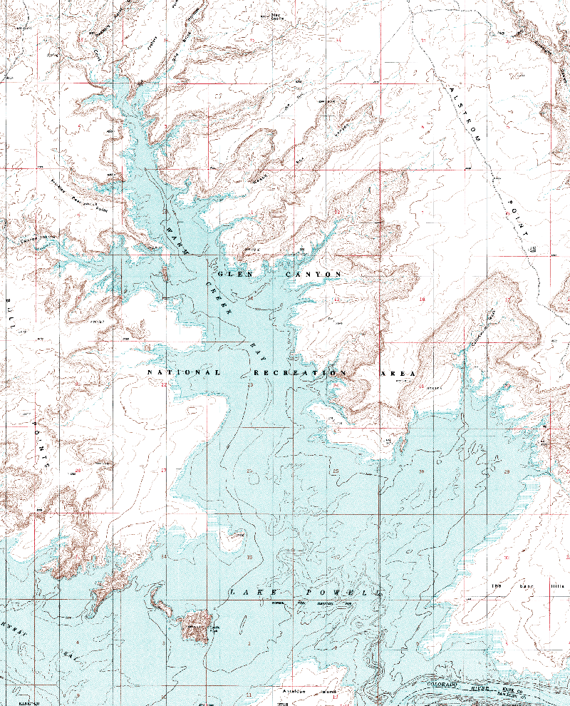
Warm Creek Bay; Crosby and Wagon Box Canyons; Cottonwood Wash

Warm Creek Bay Warm Creek Bay is a very popular site with Lake Powell visitors. It is located a few miles from Wahweap Marina, giving easy access to boaters. Many houseboats from Wahweap Marina will choose this bay because of the ease of access back to the marina if shuttling people back and forth.


There are extensive sandy beaches and several excellent coves, depending on the water level, that makes camping excellent in Warm Creek.


Spencer's Coal Mines, used in a failed attempt to use a steamboat to dredge gold from the Colorado River, were located here in the early 1900's and remnants of these can be found up Crosby Canyon.


The channel between Antelope Island and Castle Rock is known as Castle Rock Pass or Cut. When the lake drops to about 3612 feet this pass ceases to exist and boaters must go around Antelope Island through the Colorado River channel to reach Warm Creek or go farther up lake.


Adjoining Maps:

Wahweap Bay

Antelope Island

Padre Bay


Warm Creek Bay


Click on the topo map below to enlarge (Note: These are large files).

Warm Creek Topo


Topographical Map (PDF file):

Warm Creek Bay

Map Information

      Castle Rock:


      Castle Rock rises to 4,321 feet above sea level, over 600 feet above the lake.  At high water the lake surrounds Castle Rock.  Boaters should use care when trying to go around Castle Rock due to shallow water.  There are several good campsites around Castle Rock.


      Castle Rock Pass:


      The channel between Antelope Island and Castle Rock is known as Castle Rock Pass or Cut. When the lake drops to about 3612 feet this pass ceases to be passable and boaters must go through the Colorado River channel to go up lake.


      Antelope Island:


      There are extensive beaches on Antelope Island. It is accessible from Wahweap Bay, Warm Creek Bay, and the Colorado River channel.


      The Sand Hills:


      The peninsula surrounded by Warm Creek, the Narrows, and Gunsight Bay is named the Sand Hills. The name also describes the terrain. There is limited access from the lake.

      Cottonwood Wash:


      A large, open bay, Cottonwood Wash has many possible campsites.


      Alstrom Point:


      This plateau overlooking Warm Creek and Gunsight Bays is the location of many spectacular photographs of Lake Powell. It is accessible by four wheel drive vehicle. For driving details, see the Driving the Lake page.


      Crosby Canyon:


      Several good campsites exist up Crosby Canyon. At high lake levels some side canyons are inundated and secluded campsites are then available. Crosby Canyon is also accessible by automobile. For driving details, see the Driving the Lake page.


      Wagon Box Canyon:


      At higher lake levels there are a few side canyons in Wagon Box Canyon that afford some camping opportunities. South of Wagon Box, in some unnamed canyons, there are some fine campsites.