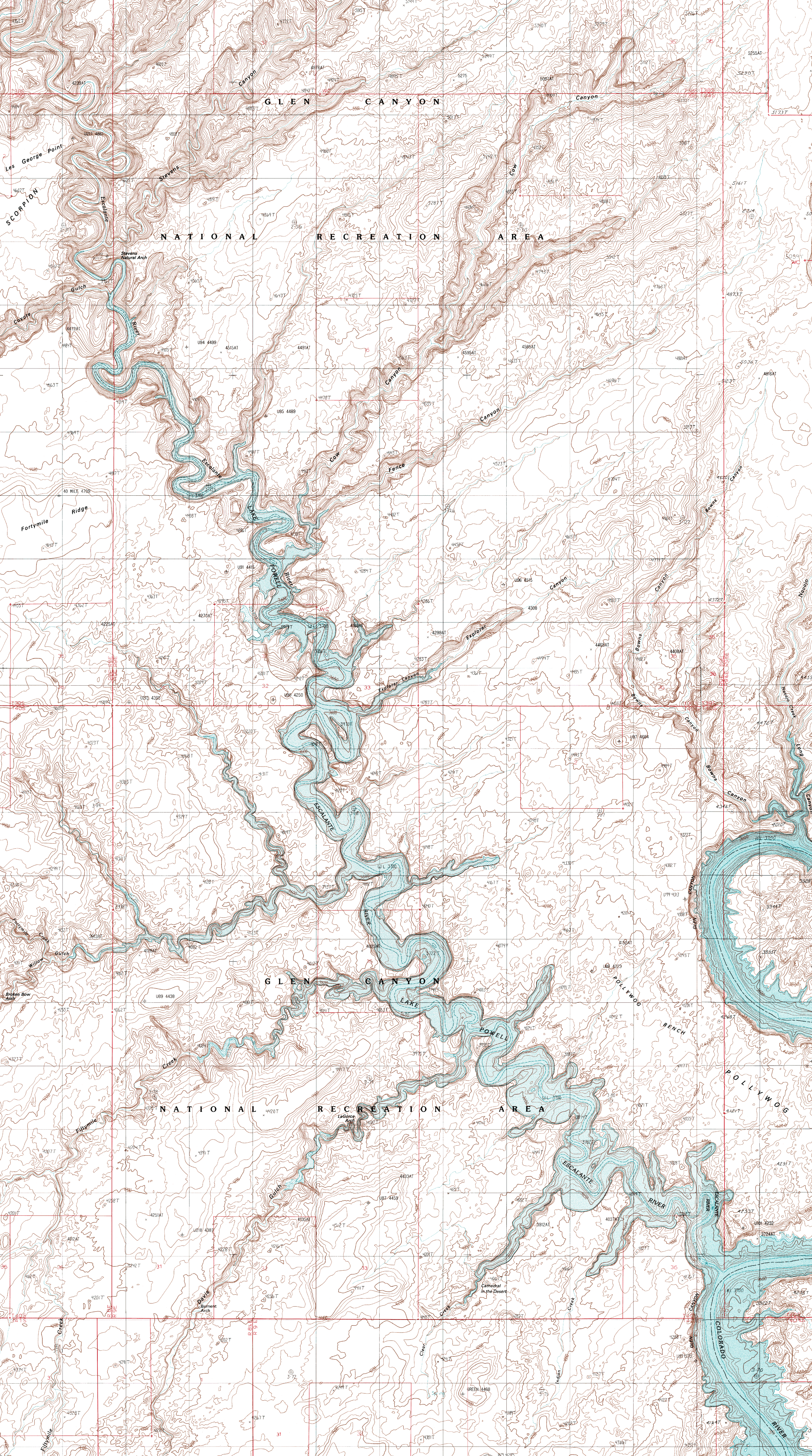
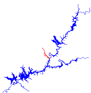
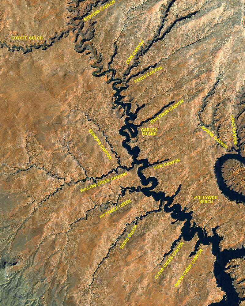
 The Escalante River Arm (Mile 68) is the second largest river arm off of the Lake Powell, next to the San Juan River Arm. It contains numerous side canyons to explore. The Escalante River Arm has no channel markers so boaters should be cautious. There are few campsites up this scenic canyon but lots of good hikes. There are many overhanging alcoves that are beautiful but also hazardous due to falling rock. Do not camp under these alcoves. The river was named for Father Silvestre Velez de Escalante, a leader of the 1776 Dominguez-Escalante Expedition.
Adjoining Map:
The Rincon
Click on the topo map below to enlarge (Note: These are large files).
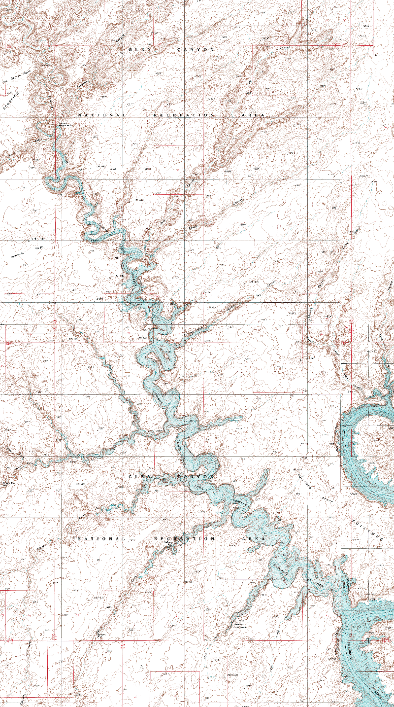
Topographical Maps (PDF files, opens in a new window):
Davis Gulch
The Rincon
The Rincon NE
Stevens Canyon South
Indian Creek Canyon:
Indian Creek Canyon, about a mile and a half up the Escalante River Arm, offers no camping.
Clear Creek Canyon:
The "Cathedral in the Desert" at the end of Clear Creek Canyon and is exposed at lower water levels. There are no campsites in Clear Creek Canyon.
Davis Gulch:
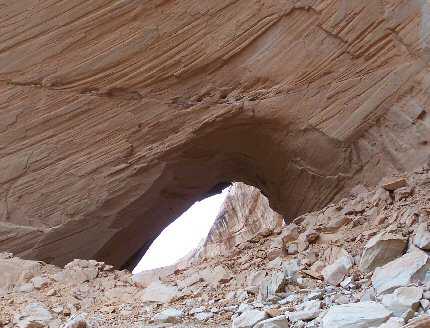
Davis Gulch is six miles up the Escalante River Arm. It was named after John Davis, a pioneer cattle rancher in the area. Two miles up Davis Gulch lies LaGorce Arch, shown below. You can view both sides of this arch by boat. There are few or no campsites up Davis Gulch. A difficult hike up the gulch at lake's end will bring you to Bement Natural Arch, a 100 loot long, 80 foot high arch.
Fiftymile Canyon:
Fiftymile Canyon, 7 miles up the Escalante Arm, may offer some camping opportunities depending on the lake level.
Dow Canyon:
Nine miles up the Escalante River Arm, Dow Canyon has steep walls with few or no campsites.
Willow Creek Canyon:
Willow Creek Canyon, at Mile 10, may have a few campsites toward the end. Hiking up the end of Willow Creek Canyon leads to Broken Bow Arch, 94 feet wide and 100 feet high. Bishops Canyon veers north approximately a half mile up Willow Creek Canyon.
Explorer Canyon:
Twelve miles up the Escalante Arm, Explorer Canyon offers no campsites but there is good hiking up the end of the canyon.
Fence and Cow Canyons:
Fence and Cow Canyons share a common mouth 15 miles up the Escalante River Arm. Water does not go far up but hiking opportunities are available in both canyons.
Coyote Gulch:
Coyote Gulch, 21 miles up the Escalante Arm, is accessible at high water levels. Hiking up Coyote Gulch reveals several natural bridges and arches.
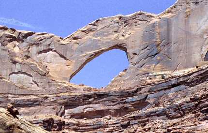
Stevens Canyon:
One can hike up the Escalante River to reach Stevens Canyon. The highlight of this hike is Stevens Arch, shown below.