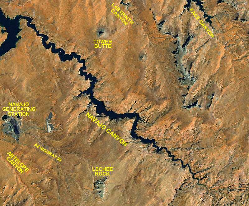
 Navajo Canyon is located 9.5 miles up lake from Glen Canyon Dam on the east side of the main channel. This 16 mile canyon contains beautiful walls of Navajo Sandstone. There are few campsites available. Driftwood accumulates toward the end of this canyon so boaters should proceed with care.
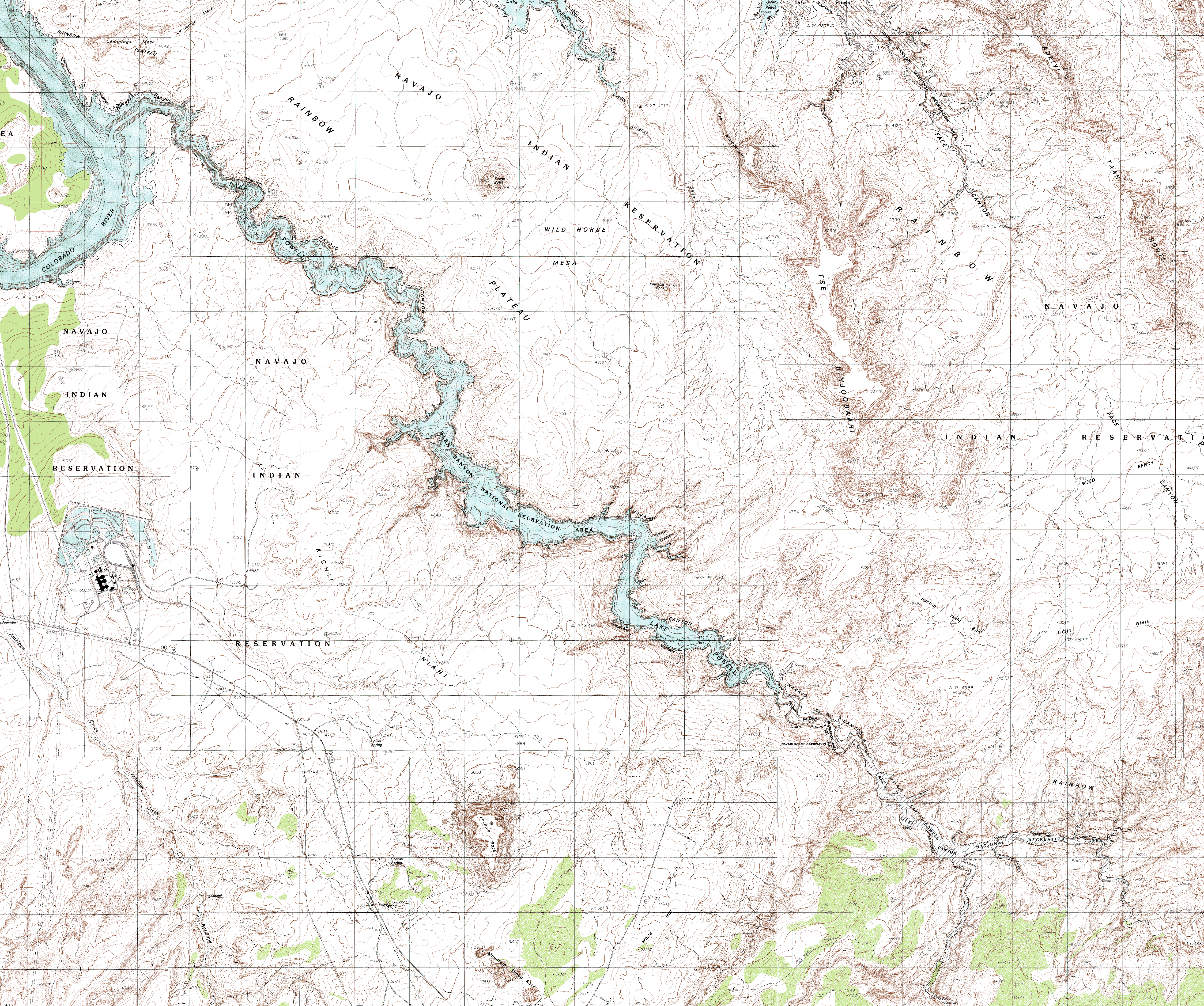
Click on the topo map below to enlarge (Note: These are large files).

Topographical Maps (PDF files, opens in a new window):
Page, AZ
Wild Horse Mesa
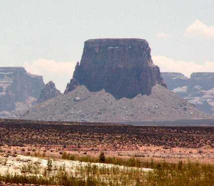
Tower Butte:
Tower Butte rises to 5282 feet above sea level, close to 1600 feet above the lake level at full pool.
Chaol Canyon:
Chaol Canyon splits off to the right at the end of Navajo Canyon. There is some nice hiking up Chaol Canyon if the lake is at a level where silt is not a problem. There is a waterfall and some petroglyphs up this canyon.
Navajo Generating Station:
Navajo Generating Station is a coal fire power plant located on the Navajo Indian Reservation. It provides power for the Central Arizona Project and many towns and cities in the U.S. Southwest.